GIS & Maps · Case study
Commercial Lot-Mapping System: how we digitized lot sales for real estate developments
The lot management and sales system we've built most often for real estate clients: an interactive map, real-time status, and online reservations, instead of spreadsheets and printed brochures.
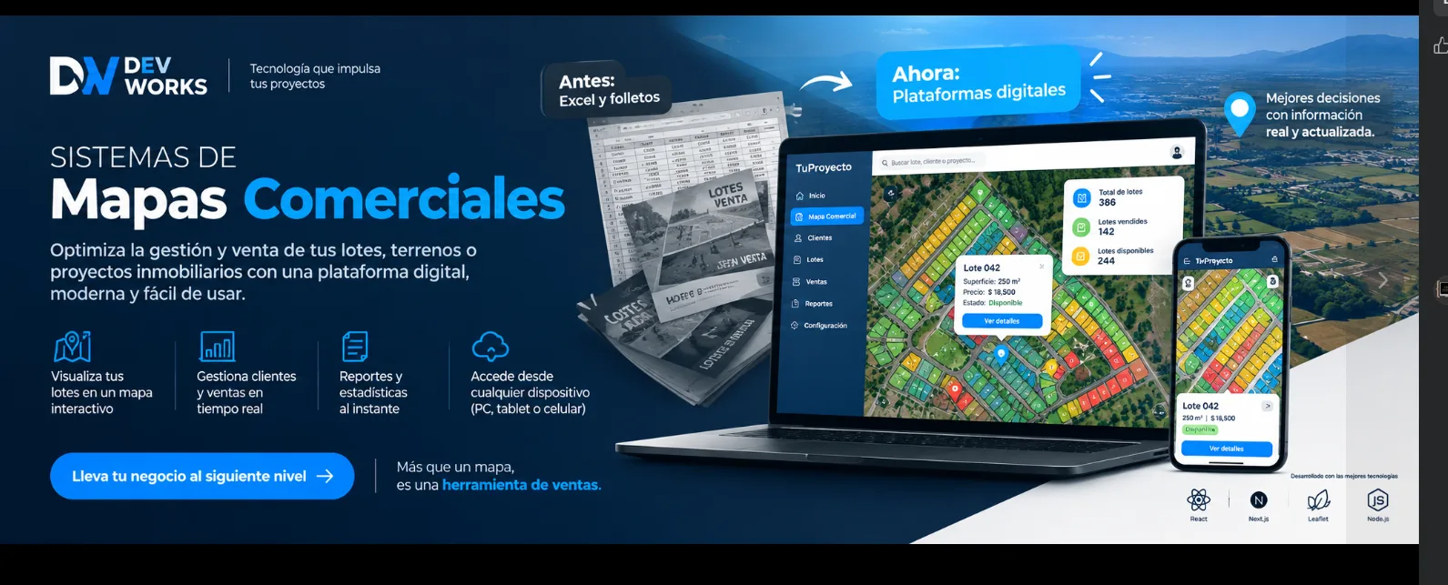
Lot sales in a real estate development are almost always managed the same way: a spreadsheet tracking each lot’s status, and printed brochures with a site plan that’s outdated the moment the first lot sells. The problem shows up once the sales team grows — two different salespeople, two different spreadsheets, or one shared sheet nobody remembered to update — and they end up offering the same lot to two different buyers.
That was the starting point for one of the internal systems we’ve built most often at Dev Works: a platform with an interactive map to manage and sell lots for real estate developments, designed to fully replace the paper site plan and the shared spreadsheet.
What the system solves
An interactive map per project. Each development is loaded as a real site plan on the map, with every block and every lot drawn as its own polygon — not a static image, but actual data you can query.
Real-time status, color-coded. Red for sold, green for available, yellow for reserved, with green areas marked separately. Anyone on the team can see at a glance what’s still available, without having to call someone to confirm.
A full record when you click a lot. Block and lot number, surface area in m², price per m² and total price, current status, and even a real photo of the land — all the information that used to live scattered between a spreadsheet and a salesperson’s memory.
Built-in reservations and a payment simulator. A prospective buyer can simulate what installments would look like and leave a reservation without ever leaving the map, right at the moment they’re looking at the lot they’re interested in.
An admin panel with roles. Users, Lots, Reservations, History, and Roles, so the whole team — sales, administration, management — works from the same source of truth, each with the permissions that fit their role.
Why it replaces spreadsheets and printed brochures
A printed brochure goes out of date the same day the first lot sells. A shared spreadsheet has the usual problem: someone edits it, someone else has it open with stale data, and eventually two salespeople offer the same lot to two different clients. Centralizing everything in a map that updates instantly — and that anyone on the team can check from their phone, tablet, or computer — removes that risk at the source, instead of trying to manage it by hand.
One system, built to be reused
We built it so each development loads its own site plan, its own lots, and its own sales status, on top of the same underlying system — we don’t start from scratch with every new client. It’s the system behind the commercial map for Urbanización Ciara, in San Borja, and it’s one of the solutions we’ve built most often for real estate clients in recent projects.
If your business sells lots, land, or units in a real estate development and still relies on a printed site plan or a shared spreadsheet to know what’s available, you probably already know the risk of selling the same thing twice. Let’s talk about how to digitize it.